Norway’s Pulpit Rock Hike

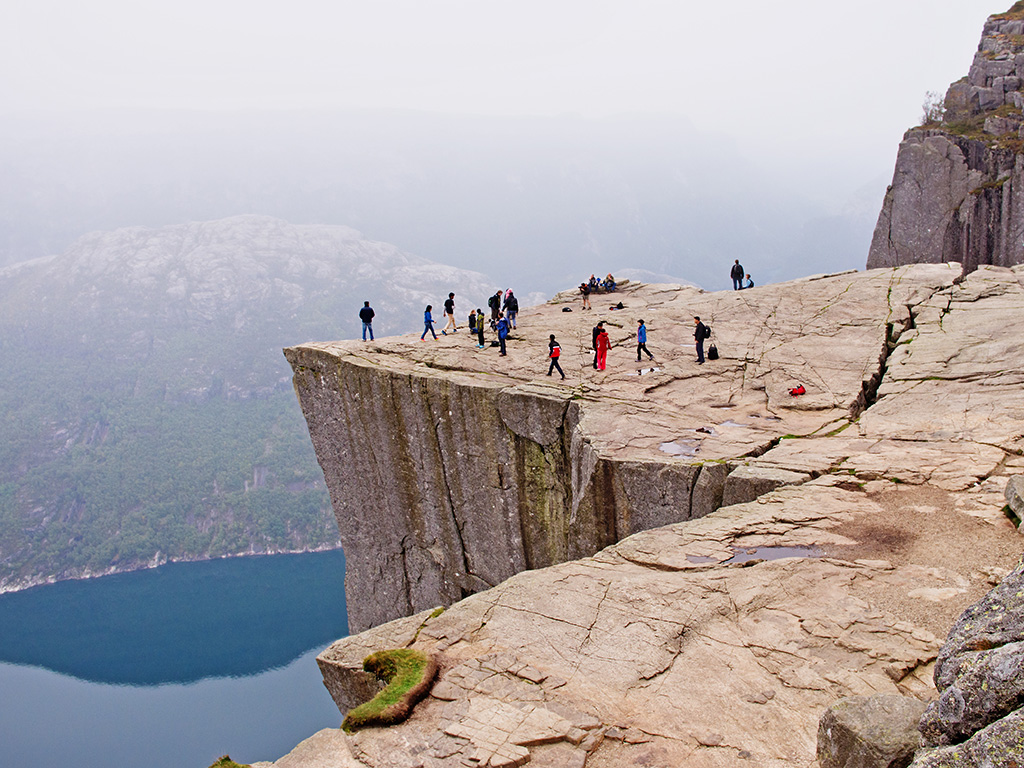
Pulpit Rock (Preikestolen) is perhaps one of the most famous attractions in Norway and can only be reached on foot. This rock plateau is well-known for its (almost completely) flat surface, towering hundreds of meters above the Lysefjord below.
The plateau is found at 604 meters (1,980 ft) above sea level, and the hike to reach it is a little over 4 kilometers (2.5 mi).
This is a very popular hike, and the trail is well marked and clear the entire way to the top. You will pass through both forested and mountainous landscapes, as well as marshlands (where wooden planks have been laid to make it easier to cross). There are also some stone steps to climb, but the hike is not technical. Still, you should have some experience hiking and be dressed properly for a mountain hike. Additionally, it is not ideal for those who are afraid of heights. The final leg of the trail up to the viewpoint is quite “airy,” as Norwegians say, with a long drop on one side and no fence or railing. Always tread carefully and take your time.
The hiking season for Pulpit Rock starts in May (as soon as the snow melts) and ends in October. The trail is usually very crowded, so if you want to avoid encountering too many other hikers, aim to start your hike early (before 9am) or later in the day (after 4pm).
Hiking Pulpit Rock can take anywhere between 1 and 2.5 hours one way, depending on your pace. It is a great hike, where you gain about 330 meters (1,080 ft) of elevation, and are treated to incredible views of the fjord below as a result.

Getting to the Pulpit Rock Hike
The Lysefjord, a 42-kilometer (26-mi) long fjord, is home to the popular hike to Pulpit Rock, which overlooks the fjord. At its deepest, the fjord is 422 meters deep (1,384 ft). Along the fjord there are several famous hikes in addition to Pulpit Rock, such as Kjerag and the Flørli Stairs. Therefore, this destination outside of Stavanger is a haven for outdoor enthusiasts and those seeking spectacular fjord views.
The start of the fjord is at Oanes and Forsand, 46 kilometers (28 mi) from Stavanger. From there, the fjord stretches northeast all the way to Lysebotn, where it ends. Traveling by boat is the easiest way to get from one destination to another along the fjord, and some spots are not even reachable by car (such as Flørli). Bear in mind that transportation around the Lysefjord is not the easiest, and you will be dependent on ferry departure times to cross the fjord. Therefore, expect to spend at least one night in the Lysefjord area (either on the Pulpit Rock side or the Lysebotn side of the fjord) if you are planning on hiking. The fjord itself can be seen in a day trip from Stavanger.
The stops along the Lysefjord (from start to end) are Lauvvik, Oanes, Forsand, Songesand, Flørli, and Lysebotn. Scheduled car ferries service these stops through the summer. Most of these are not considered destinations themselves, as the sight here is the fjord. Therefore, you will not find restaurants or hotels in this area. Expect simple accommodations aimed at hikers.
Start planning your adventure
Pin it for Later


